La Paz:
• CICESE Unidad La Paz
• Parque Nacional
Archipiélago de Espíritu
Santo
• BOA Outfitter
Weather and Tide forecast:
• Buoyweather
• Windfinder
• Tide forecast (CICESE)
Kayaking around Espíritu Santo and La Partida Islands
This is a 7 day activity in the Parque Nacional Archipiélago de Espíritu Santo.
Introduction
Download the GPS file
Day 1: From Dispensa to Reef
Day 2: From Reef to Cardonalcito
Day 3: From Cardonalcito to Embudo and Los Islotes
Day 4: From Embudo to Mesteno
Day 5: From Mesteno to Gallo
Day 6: From Gallo to Coralito
Day 7: From Coralito to Dispensa
Download the Waypoints file
Introduction
This circumnavigation to the Espíritu Santo and Partida Islands is a 7 day expedition in the Archipiélago de Espíritu Santo National Park (Sea of Cortés, Baja California, México). This route defines a figure 8 circling both islands. It starts at the Dispensa beach in the southwest of the Espíritu Santo and begins moving counter clockwise along its east coast. It crosses to the West through the split between both islands and circles the Partida clockwise. Crosses again through the split and keeps south now on the west side of Espíritu Santo back to Dispensa beach.
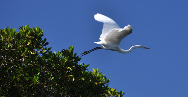
The Espíritu Santo Island is 4.5 miles offshore of the East coast of the Baja California Peninsula, close to La Paz. The islands have no permanent inhabitants. Only a few fishermen live there in small shacks for short periods of time. The turquoise waters surrounding the islands are immensely rich in wildlife. Dolphins, manta rays jumping out of the water, sea lions, infinite species of fish and crustaceous. Occasionally, whales and sea turtles can be spotted. Also a great variety of birds live in these islands: cormorants, blue foot bobbies, pelicans, egrets and herons, frigates, ospreys, etc. On land you can find very unique fauna too. The babisuri (ringtail), black hare and several species of reptiles can be seen. If you enjoy kayaking in a paradise surrounded by wildlife, this should be your next destination.
The east coast of the islands is rugged with towering cliffs, sea caves and a few and far apart rocky beaches. Make sure you plan your legs accordingly to reach a beach to spend the night. On the other hand, the west coast has lots of spectacular golden sand beaches. The east coast is fairly straight and it’s difficult to find not exposed areas if the wind picks up. On the west, deep bays offer more shelter but paddling close to the shore means extra miles compared to skipping a bay by kayaking from cape to cape. Also on the west coast there are a few small islands less than 1 mile off the coast that can be easily reached in calm weather; visitors are not allowed to set foot on them.
La Partida (Split) island is separated from the Espíritu Santo by a narrow and very shallow passage of water. This is one of the most likely spots to find fishermen. Half a mile off the northern tip of La Partida, a colony of sea lions lives on Los Islotes, a small rocky island. A line of buoys marks the closest you can get on boat or kayak to the rocks. You can snorkel inside the protected area.
On the southwestern part of Espíritu Santo there is a meandering mangrove that takes you to a different world. Forget about the expanse views. You are now on a narrow channel with a different repertoire of bird calls and crackling sounds coming from deep inside the mangroves. By the way, time your visit since it’s only accessible at high tide.
Don’t forget to visit the old pearl farm. On high tide, you can paddle inside the main lagoon and get up close with frigates, pelicans and many other birds. It’s also interesting walking around to see the man-made channels to guide the water for the pearls cultivation.
To finalize this introduction to the natural wonders of the island, it’s worth mentioning that there are several rewarding hikes on land. Don’t limit your stay on land to the beaches, walk around either to get to a vantage point for the view or to check on the local flora and fauna. Use the marked trails or climb up the canyons. You’ll be amaze by how much life is there, especially on a “rainy” year.
Day 1: From Dispensa to Reef
Facts:
Distance: 7.9 miles
Duration: 4 h.
Date: 05/24/2009
You can paddle from La Paz to the island but the stretch of the mainland coast is very busy with commercial and recreational boats. Balandra is a nice beach on that section but it’s frequented by people since you can get there by car. So, unless you have plenty of time, arrange a drop off to the islands with one of La Paz outfitters.
Description of the route:
 This first day is a short one, which is adequate due to all the time it will
take to get there and ready to paddle. The crossing with the panga takes 45 minutes
to an hour. On the way to Espíritu Santo we spotted a fin whale.
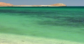
We were dropped at the Dispensa beach (WP DispensaStart). Since this is the closest beach on the island to the city, it’s likely to find fishermen fishing here. Parrot fish is a typical catch. Inland of the beach you can see a small volcano. This route paddles around the south tip of the island and the Punta Lupona, where there is a nice beach. The next bay North, Playa Bonanza, is the longest of the island (around 2 miles) and there is good snorkeling at the boulders of the northern tip. During this stretch, you can still see the coast of mainland and how it continues south.
The last beach on this side of the island is past the lighthouse at the reef and before Punta Lobos. Choose a high spot for your tent since the tide percolates through the sand on the obvious drainage (WP Night1 Reef Beach).
Day 2: From Reef to Cardonalcito
Facts:
Distance: 12.3 miles
Duration: 8:30 h.
Date: 05/25/2009
Description of the route:
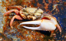
The second day is the longest and riskiest one. Espíritu Santo’s East coast only has a couple of rocky beaches good for a rest but not for camping. The first one is at the exit of a lagoon (WP Lagoon) 2.6 miles up the coast. You cannot get into the lagoon with the kayak, even at high tide. The area around the lagoon could be a potential place to camp but it would require some portage. Howeer, it’s worth exploring the area on foot. Make sure you secure your kayak properly since there are not many anchors around. The salty lagoon is home of some sort of small Violin crab (see picture above). On its shore, you can also see interesting salt crystal formations.The next possible place to stop is at Boulder’s beach (WP Boulders Beach) 5.1 miles from the Reef campground. It’s a good place for lunch but is not protected against winds and there is no place to pitch your tent.
 At
6.9 miles from the beginning, you’ll find a rock tower separated from the island
by a narrow channel teaming with life. Here we saw a pod of dolphins passing by
pretty close (see picture).
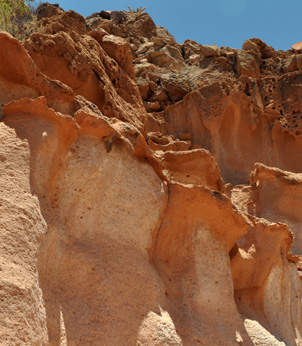
Farther up the coast, a sea cave can be explored and crossed from one entrance to the other at high tide. This is an excellent place for snorkeling. At this point, the Partida Island has been visible for some time and the passage separating both islands becomes clear. Pay attention to the walls on your left before entering the channel for curious rock colors and formations.
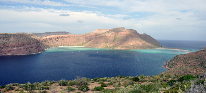
You will turn west approximately at mile 9 heading for the channel (see
picture above). At the sand spit, you’ll see a few shacks and probably some
fishermen that will try to sell you a fresh catch or a warm beer. The channel
gets very shallow and only small boats can cross it so you won’t find traffic
here. The west side of the channel is a preferred anchor spot for recreational
boats. We landed at Partida Beach at mile 10 (WP Partida Beach)
for a rest after the long rocky stretch of the east coast but Shallow's
Beach (WP
Shallow's Beach) is a better choice.
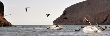 There are 2.3 more miles to the Cardonalcito Beach (WP Night2 Cardonalcito),
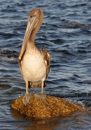
your camp for tonight. We were rewarded by a flock of pelicans feasting
on a school of fish, taking flight and plunging from the air repeatedly.
Wildlife in action!
Day 3: From Cardonalcito to Embudo and Los Islotes
Facts:
Distance: 5 miles + 4 miles to Los Islotes and back
Duration: 2:15 h. + 4:30 h to Los Islotes and back
Date: 05/26/2009
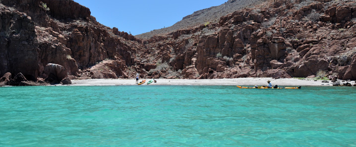
Description of the route:
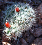
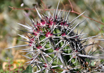
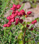
On this day we skipped El Cardonal and Ensenada Grande bays to go straight to the Embudo (Funnel) beach. On a different occasion, we landed on the Cardonal Beach and hiked the signed trail to the other coast of the island. That had been a rainy year for Baja’s standard and the land had a green carpet dotted with colorful flowers (see pictures below).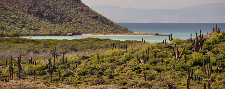
Once we got to the Embudo Beach we unloaded the kayaks and head for the
Los Islotes. Although this visit is optional, it’s highly recommended. The
bay where most of the sea lions are is protected by buoys to prevent
boats or kayaks to get to close to them. You can swim and snorkel inside though.
The snorkel is good here and you can see big parrot fish. Swimming with the sea
lions, you realize how fast and agile they are in the water. Be aware of the
mating season and their mood. Locals say that if they “bubble” you, back off,
you’re too close. This warning sounds more like a splash or explosion than a
bubbling sound. It’s recommended to explore around the rocks to see other sea
lions and sea birds. It is not allowed to land on the rock. Go back to the Embudo
beach camp (WP Night3 Embudo).
Day 4: From Embudo to Mesteno
Facts:
Distance: 10.9 miles
Duration: 6 h.
Date: 05/27/2009
Description of the route:
 This is another long day and may be tricky if the wind picks up since the
east side of Partida has only one (unprotected) spot to land (WP Rocky
beach). From the Embudo beach, paddle north and go around the north
tip of Partida and then south on its east coast. Enter the Partida channel
as you did two days ago. This time we landed at the nicer Shallow’s Beach (WP
Shallow's Beach). From here, cross the channel and aim for the first
cape of Espíritu Santo. Behind it’s the camp for the night at Mesteno Beach (WP
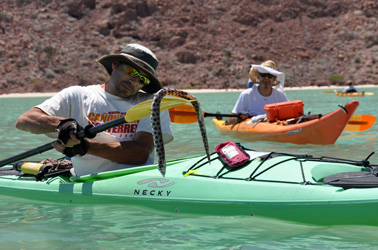
Night4 Mesteno). We hand fed moray eels here while cleaning our catch
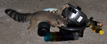
of the day at the shore... Look for babisuris (ring tail) at night.
Day 5: From Mesteno to Gallo
Facts:
Distance: 8.8 miles
Duration: 6:50 h.
Date: 05/28/2009
Description of the route:
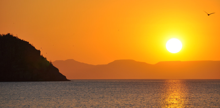
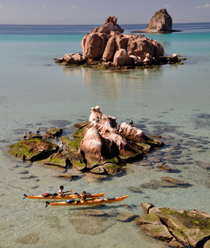
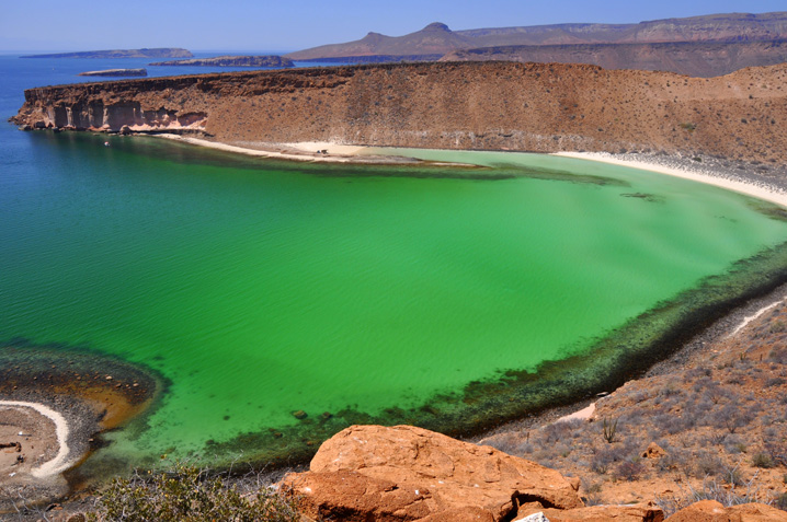
Candelero, the bay south of Mesteno is one of the most beautiful beaches you can find. It has two golden sand beaches separated by a pink rocky spur that continues inside the crystal clear waters with a chain of small islands. When the sea is calm, the kayaks seem to float a couple of feet above the sea bottom. Despite the usual permanent outfitter camp, it’s worth it to land and explore the trail to the well and beyond for the attractive rock formations and the superb views of the bay from a high point. You’ll be also rewarded by the shade of exuberant vegetation fed by the subterranean water.After leaving the Candelero Bay, paddle into open waters towards the Ballena (Whale) island. The west tip is an excellent fishing area. Circle the island, and head back to Espíritu Santo. The closest beach is at WP Beach. Gallo Beach is our destination for tonight’s camp (WP Night5 Gallo). Its north part offers shelter from the wind. There is good snorkeling in that part of the beach too. The sunsets are magnificent here. At night, you will be probably visited by the local smart babisuri.
Today, in Candelero, we picked up our supply of water and food brought by the guys we rented the kayaks from.
Day 6: From Gallo to Coralito
Facts:
Distance: 5.7 miles
Duration: 5:20 h.
Date: 05/29/2009
Description of the route:
Since today is a short one, we backtracked and explored the bay north of our camp. At the end of it, there is a mangrove with lots of birds. After that, pay a visit to the Gallo and Gallina islands. The camp for the night is in Coralito Beach (WP Night6 Coralito). From the south end of the bay begins a path that leads to the top of the cliff where you can enjoy vistas of all three islands off Espíritu Santo. Also the lagoon south of Gallo is visible from here.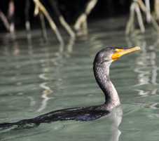
Day 7: From Coralito to Dispensa
Facts:
Distance: 6.7 miles
Duration: 3:40 h.
Date: 05/30/2009
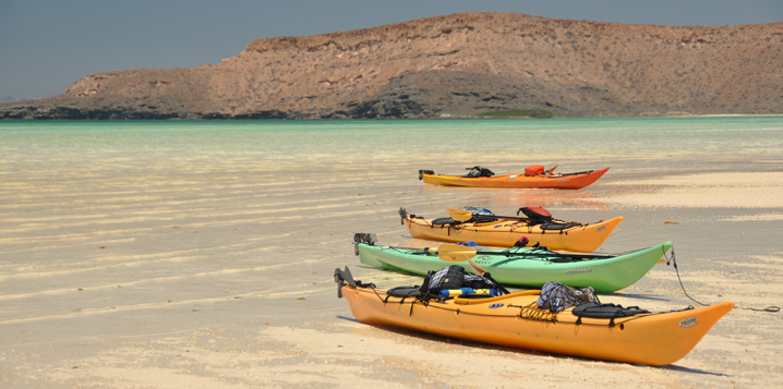
Description of the route:
The lagoon just south of Coralito is not accessible by kayak. Its exit point is home of a gazillion of sea cockroaches that crawl away from you as you walk. South of the lagoon is the big wide San Gabriel bay. The beach at the north side of the bay is not recommended (WP San Gabriel Beach (North)). It has bugs, algae and lots of rays. As you paddle towards the end of the bay, it gets shallower and shallower. Depending on the tide, you may have to pull your kayak to get to the mangroves (WP San Gabriel). Close to the shore, when the tide is low, you can find short sticking out tubular forms made of sand probably from some worm or mollusks buried in the sand.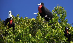 Don’t miss the now abandoned pearl farm on the southeast corner of the bay
(WP Lagoon (Pearls)). During high tide you can paddle in and
enjoy a great variety of sea birds perched on the mangrove trees like frigates,
herons, egrets and pelicans. If you’re quiet and stop paddling you can get very
close to them. Make sure you get out before the tide is too low. It’s also a good
idea to land and check the man-made serpentine channels used to cultivate the
pearls.
Le grand finale of this adventure lies in the Colorado bay. On its most eastern end (WP Hidden Mangroves) is the entrance to a passage between mangrove trees that snakes for 200 yards to a secluded lagoon. Along the way you can see a different type of crab on the exposed roots, hear new bird calls and a mysterious crackling sound. After the visit, keep paddling south till you get back to the Dispensa Beach (WP DispensaEnd) and enjoy your last piece of Baja while you wait for your transport back to civilization.

