• GPX file
• Profile
• Logbook
• Where are we?
Photo album:
• The Southern Alps
Recommended services:
Did you find our website useful?
THANK YOU!
Leg breakdown:
Date Activity Leg Distance (Km) Elev. Gain (m) Elev. Desc. (m) 3-Mar-19 Riding Oamaru to Duntroon 54.3 509 377 4-Mar-19 Riding Duntroon to Te Akatarawa 53.4 181 45 5-Mar-19 Riding Te Akatarawa to Omarama 41.9 429 259 6-Mar-19 Riding Omarama to Ohau Lodge 42.9 513 387 7-Mar-19 Riding Ohau Lodge to Twizel 38.0 103 183 8-Mar-19 Hiking Sealy tarns hike 539 522 9-Mar-19 Riding Hooker valley lookout and Tasman lake 21.5 333 361 10-Mar-19 Riding Mount Cook Village to Lake Pukaki 59.7 253 455 11-Mar-19 Riding Lake Pukaki to Lake Tekapo 44.3 276 83 16-Mar-19 Hiking Rob Roy glacier 14.9 527 522 17-Mar-19 Riding Wanaka to Makarora 67.5 513 483 18-Mar-19 Hiking Brewster hut 3.8 953 21 19-Mar-19 Riding Makarora to Pleasant flats 38.1 429 1643 Total 496.9 5558 5341
3-19 March, 2019: The Southern Alps
After touring the southeastern coast of the South Island, our next destination is the New Zealand Alps. One of the Great Rides precisely joins the coast with the Alps. The official circuit begins at the foot of Mount Cook, the highest mountain in the country and ends in Oamaru, on the coast, right where we are. Most cyclists travel the road in that direction but we are going the other way. Actually there is not much difference. The base of the Cook is only 600 meters above sea level, which does not represent a significant difference compared to all the ups and downs along the way.
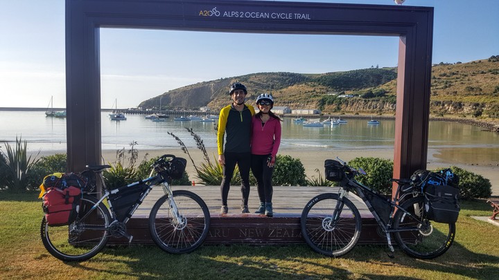
The first three days don’t have a special interest, but pedaling on this Great Ride is a good way to get close to the Alps avoiding the roads. In a couple of the campsites where we spent the night, two Kiwi families invited us to cold beer. Another example of how kind they are.
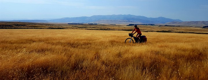
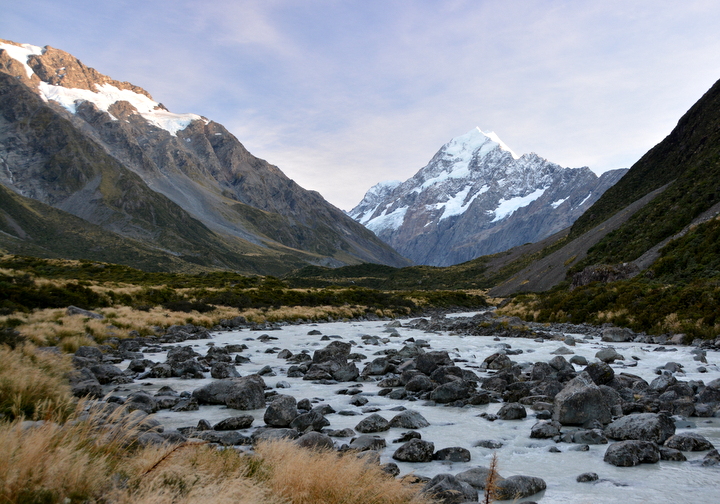
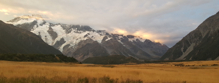
The landscape interest starts from Omarama. The plains are covered with tall grass, already dry at the end of summer, with that golden color so beautiful at sunset. At the end of that day we reach Lake Ohau, the first of the alpine lakes in the area. The water of these lakes comes from the glaciers in the mountains of the Mount Cook National Park. The park has a very high percentage of all the peaks above three thousand meters in the country and the area to which we are going has a lot of glaciers. The water of the glacial rivers and lakes has a special color, a beautiful turquoise blue due to the amount of sediments. The golden color of the prairies contrast with the intense blue of the water, creating incredible images.
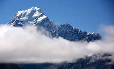
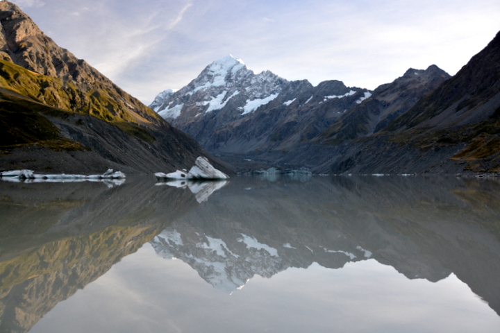
When we go to sleep, the sky is still clear and the amount of stars in the firmament is infinite. The Milky Way is very clear, the Southern Cross, Sagittarius, Scorpio. All the constellations are up there. We wake up at 4 in the morning to see if the sky is still clear. Fortunately not anymore. Our plans to climb again to the Sealy Tarns to see the sun rise over the Mount Cook are frustrated and regrettably we have to stay warm in the sleeping bag. Three hours later we go hiking in the Hooker valley, a much flatter alternative. We reach the lake of the same name from where we can see the second rays of sun illuminating the summit of the Mount Cook. The calm water of the lake reflects the peaks and crests around. In the lake icebergs float quietly. In the afternoon, we ride to Lake Tasman. From the viewpoint we can see many icebergs with some three thousand summits in the background.
To end the ride in this area we go to Lake Tekapo, located in an area especially favorable for the star gazing. There we sign up for a guided night tour to learn more and use the telescopes that the tour provides. Although they can be seen with the naked eye, we aim the telescope to the Magellan clouds. Also to stars that although they seem a single one, they are in fact a cluster supposedly orbiting around a black hole. Red dwarfs, blue giants. We expected more from the telescopes and less people on the tour. But there are few opportunities to see the stars like here so we had to try it. For us, the firmament remains a mystery. The distances are inconceivable, the forces that keep it in motion incomprehensible and the beauty infinite.
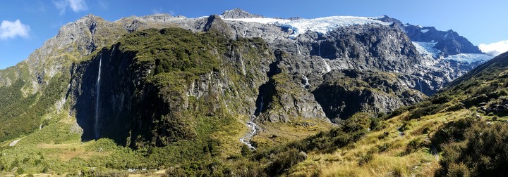
Our next destination is Mount Aspiring National Park. To get there we go by bus to Wanaka to avoid the traffic. According to some cyclists that we have met along the way, there are areas where there is no shoulder and it becomes even dangerous to ride on that stretch. The first hike in Mount Aspiring National Park is to the Rob Roy Glacier viewpoint. Between the layer of ice and the hard rock flow countless waterfalls that rush down the wall with suicidal jumps. In particular there is one, the most beautiful, separated from the others that does not crawl on the walls, but flies in free fall. It has no name but it could perfectly be called the veil of the bride (like so many others). Because of its orientation and the time of day, the sun only illuminates the blonde hair of the bride and the wind blows the white veil to the side.
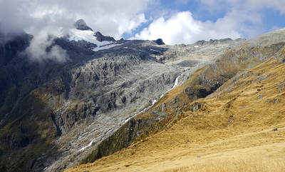 Finally it's time to get on the saddle again. We leave Wanaka towards the West Coast. Our route follows the Wahea River to the lake, then its shore until we cross the neck that takes us to the shores of Lake Wanaka. The weather is spectacular and we enjoy magnificent views all the way. We camp in Makarora from where the next day some Czechs take us to the trailhead to the Brewster hut. We leave the bikes at the campground. Once we arrive at the trailhead, we ford the river, put our boots back on and start climbing up what looks like the trail. More than hiking, we use the roots of trees as ladders to climb the brutal slope. It’s like root climbing. At 1200 m of elevation, we leave the rainforest and move into the tussocks, the area where only small shrubs and grass survive. The trail continues along the crest between the two valleys. The views are incredible. To our left, the melting water of the Mount Brewster glacier falls into a series of chained waterfalls. When we arrive at the shelter, we are rewarded with a postcard perfect picture. The plain where it is located covered with golden grasses, the dark gray rock on the other side of the valley and the multiple waterfalls separating them. The sunset is also gorgeous. To the West is Mount Aspiring (which gives its name to the national park) surrounded by some other three thousand peaks. A thick cloud rises from the valley floor. Above the peaks there is another layer of clouds. In between are the summits. The sun on the horizon throws its last burning rays towards us. Some of the most distant peaks project radial shadows on the upper layer of clouds generating an effect that we had never seen before. Definitely, it has been worth the effort to climb up here.
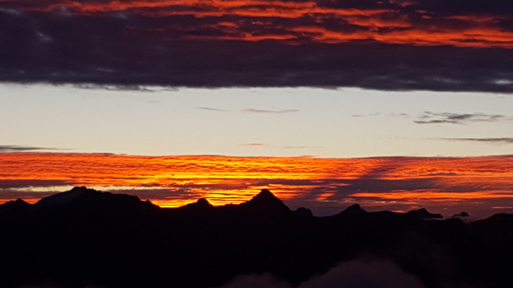
In the morning we are woken up by the noisy 4 keas who come to visit us before the sun comes up. When we begin the descent, the ridge of the trail just begins to be illuminated by the sun. Back to the parking lot where the road starts, we ask a German tourist if she can take us back to Makarora, where we left the bikes yesterday. In Makarora, we replenish our strength and start pedaling. The first stop is at the Blue Pools, a tributary of the Makarora River that pours its blue water down a narrow gorge. Yesterday, we visited with the Czech couple. Today we return to take a dip. Of course, in front of the public, you cannot hesitate and we do it macho way, as if it was not cold. When we reach a certain depth, we cannot hide a grimace that makes it clear how freezing it is.
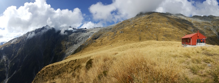
We continue our ride and cross the Haast pass, officially entering the West Coast. The descent to the town of Haast is beautiful, as well as fun. Narrow valleys open on both sides, we cross innumerable streams and the road wall drips water everywhere between mosses and ferns. Upon reaching our destination, the brake pads smell like burned and sure the discs are very hot. From the campground we can see at the end of the plain where the Haast River runs off, a mountain range covered by glaciers. We have reached the land of the glaciers.
© 2018 Explore Pangea. All Rights Reserved. Website Terms of Use.
