Download GPS files for Mineral King Loop:
• GPS track & waypoints
Photo album:
• Mineral King Loop
Sequoia NP:
• Sequoia & Kings Canyon NP
• Backcountry permits
Eating:
• Monet's (Exeter, 559-592-9453)
Mineral King loop
This adventure is a 5 day hike in the Mineral King section of Sequoia National Park.
Day 1: From Mineral King to Franklin Lakes
Day 2: From Franklin Lakes to Little Claire Lake
Day 3: From Little Claire Lake to Little Five Lakes
Day 4: From Woods Lakes to Rae Lakes
Day 5: From Rae Lakes to Onion Valley Campground
This route starts at the Sawtooth pass trail head in the Mineral King area of Sequoia National Park. Mineral King is a little known section of Sequoia. The hiking area starts a 7700 ft. of elevation, where the ranger station is. The trail climbs to the Franklin Lakes and the Franklin Pass. On the other side the route goes down and around the Forrester and Little Claire Lakes. A classic itinerary in this area is to return to Mineral King through the Sawtooth Pass but our route continues towards the Big Five and Little Five Lakes and then on to the Black Rock Pass. After that, a long downclimb leads to the Cliff Creek crossing and then up to the Timber Gap. From there, it’s all down to the car. In total it’s 37.6 miles and 10680 ft. of elevation gain in 5 days with a maximum altitude of almost 12000 ft.
The 24 miles from Three Rivers to the Mineral King Ranger Station is the most winding road we have ever seen. It’s paved almost 100%. Only a couple of stretches before and after Silver City are dirt. The drive up took us 1h 15 min. Along the way, in a couple of spots, you will see giant sequoias. Besides their monumental size, they are easily identified by their reddish and deeply rutted bark. Silver City is a congregation of cozy cabins in the middle of the woods.
Once you get to the ranger station, the office to pick up the permit is on the left hand side. There are several parking spots to start this hike. We chose the one at the Sawtooth trail head. You can also park at the end of the road, at the Mosquito Lake trailhead parking but according to the rangers, the marmots are more active there. They crawl under the car and get into the engine to chew the hoses and any rubber they can find. There are different methods people use to avoid them. Some put chicken wire around the car and hold it with stones and ropes. Another is to lay 1 or 2 pieces of tarp on the ground and drive the car on top of them. Then use a string to wrap it up covering any entry point for the rodents under the hood or around the rear wheels. A guy that has been coming to Mineral King for 25 years showed us a new method. Put the strongest pepper you can get inside a sock. Tie the open end of the sock to a flexible metal wire that can be shaped as a hook. Hang it from any part under the hood so the sock tip is below the engine. He said that’s the best way to keep the marmots away and much quicker to implement… He was leaving and gave us his sock but since we had our tarp already setup, we now have two protection levels. Plus the car next to use has nothing. We’re good to go!
Day 1: From Mineral King to Franklin Lakes
Facts: 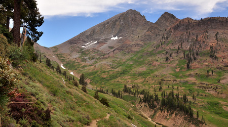
Distance: 6.3 miles
Elevation gain: 2670 ft.
Total descent: 50 ft.
Duration: 4:20 h.
Date: 07/04/2012
Description of the route:
From the Sawtooth trail head (7700 ft.), follow the paved road away from the ranger station. After 0.2 miles, you’ll get to a fork. The right road goes to the Mosquito Lakes trail head. The left one is the Franklin Pass trail head. Cross the fence, pass the pack station and keep walking along the river. The trail is wide here and only slightly uphill. Even this close to civilization, in the first half mile we saw a foot long thin snake, a marmot peacefully sunbathing on top of a rock 6 feet from us and some kind of female Grouse (maybe a Blue Grouse) with its chick. The first 1.5 miles are fairly flat. Multiple species of wild flowers pop up along the trail, including Crimson Columbines, Sierra Shooting Stars, Indian Paintbrush, Meadow Lupine and many many others. As you make progress, you’ll cross 2 creeks with beautiful wide waterfalls coming down from the peaks to your left. Gradually, the trail becomes steeper and at mile 2.1 the switchbacks begin.
At mile 4.0 you’ll get to the Farewell Gap junction. Go left. After the junction there are a couple more creeks to cross and from where you can get water. At mile 5.0 you have to cross a wider river. If you hike upstream a few yards, there is a narrower crossing. Find the trail on the other side and keep going up through the switchbacks. At mile 5.8 there is a campground for 2, maybe 3 small tents and a bear box. From here you can see the Franklin Lake dam. If you keep walking until mile 6.3, you’ll be rewarded with another campground with lake views from high up and the glacier cirque that feeds the 2 lakes.
The goal for today was to arrive at Little Claire Lake but clearly that was very optimistic. Probably one of the reasons we are more tired that we would have imagined is because we spent the night at Exeter (instead of Mineral King). It’s a better idea if you can sleep at Mineral King to start acclimatizing to the elevation.
Profile from Mineral King to Franklin Lakes.
Day 2: From Franklin Lakes to Little Claire Lake
Facts:
Distance: 7.2 miles
Elevation gain: 2025 ft.
Total descent: 1975 ft.
Duration: 5:00 h.
Date: 7/5/2012
Another hard day for your legs and knees. The climb to the Franklin Pass followed by an even steeper downhill to the same elevation you started today plus the thin air will take a toll on your body.
Description of the route:
Having breakfast on our rocky viewpoint is a good way to start the day. The clear water of the lake below is only disturbed by the small trouts breaking the glassy surface. The marmots on the neighboring rock are already busy searching for food. Today there is a special mint scent in the air.
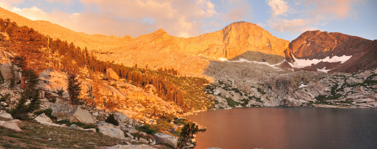
The hike up back to the bear box and to the trail is only a shy warm up for the climb to the Franklin Pass. The trail is a perfectly constant gradient that lasts 2.8 miles and climbs 1450 ft. The terrain is made up of loose granite gravel and sand that makes our progress slow. It takes us 1:45 h to get to the pass. On the way up we discover the other 2 lakes that give name to the Franklin Lakes. The views from the switchbacks close to the pass are awesome. As usually, when you think you are arriving to the top, you realize it is farther up. Almost at the top of the pass, there are a couple of spots for an emergency camping. Also at the very top of the pass there is a spot for a small tent with a nice windbreak. Obviously these will be the coldest and windiest spots you can find.
Once at the pass (11838 ft.) you will see the Forrester Lake and another one without name to its right. The Little Claire Lake is not visible. The trail down the pass runs through a sandy barren land and is steeper than the climb up on the other side. It’s also rockier and with some slippery steps. At mile 4.4 the trail becomes almost flat and a nice green meadow opens up. There are good options for camping here and there is also a stream running through the meadow. This is your last chance of a decent place to spend the night before the pass if you are going the other direction.
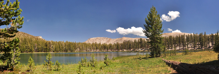
After this, the rest of the day goes through pine forest. The trail is not particularly well marked so pay attention to additional marks like cairns and man cut logs. At mile 4.9 there is a junction. The trail to the right goes to the Shotgun Pass but it’s not very used and you would not recognize it as a trail if it wasn’t for the logs marking it. We go to the left.
At mile 5.3 there is another junction. Take the left fork again towards the Forester Lake. The lake shore is at mile 6.0. The lake is surrounded by trees and grass. The sunny day and the calm wind makes it a perfect place for lunch. There are excellent opportunities for camping here but we continue towards Little Claire Lake.
The trail here is confusing again in some stretches. The first 0.8 miles from Forester Lake are uphill. After half mile more you’ll be at Little Claire shore. This is a smaller lake and not so densely forested. However, the view from the shore across the lake is spectacular. The mountain range in the background is worth to stop for the day. Also the gravel in between the old pine trees is soft and will make a good mattress for tonight. At sunset, the bark of the trees turns orange creating a very cozy atmosphere.
Profile from Franklin Lakes to Little Claire Lake
Day 3: From Little Claire Lake to Little Five Lakes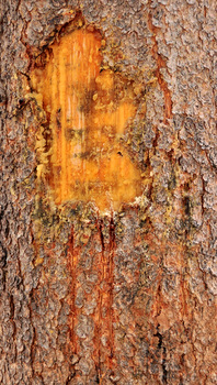
Facts:
Distance: 11.1 miles
Elevation gain: 2400 ft.
Total descent: 2400 ft.
Duration: 6:45 h.
Date: 7/6/2012
Description of the route:
The day starts going around the lake till the drainage where a zigzagging trail takes you down the valley below. The terrain through this forested mountain side is very good with compacted dirt. At mile 1.1 you cross the Soda Creek and start a gentle downhill for about 3.25 miles that will take you to a junction. The trail till here has a combination of dense forest with ferns, some marshes with wood bridges and open meadows. That junction is at mile 4.3 and you’ll take the left fork. Here starts the big climb of the day.
At mile 5.0 you will cross the Chagoopa Creek. The mosquitos that have been annoying you during this climb will intensify their attack. Here we saw a mountain quail. The trail keeps going up and meets the creek again at the junction that goes to the Sawtooth Pass to the left (crossing the creek again). We go to the right towards the Big Five Lakes. We are approximately half way the climb.
At mile 7.1 we find an unnamed lake where we take water. At mile 7.6 we arrive at the first pass of the day and start our way down to the lower Big Five Lakes.
At mile 8.2, right after crossing the creek out of the lake through a log chaos, is the campground and the bear box. Another tough climb will take you to the Upper Big Five Lakes junction, at mile 9.3. Just 0.1 miles after, you arrive at the second pass of the day. With some less significant ups and downs, you finally arrive at the Little Five Lakes campground, at mile 11.1. Right at the entrance of the campground there is a bear box. Following the trail past the campground and crossing a small stream there is a Ranger Station but there was nobody when we were there.
Relax after the long and tough day with a bath in the lake. The water is surprisingly not gelid. The sun feels so good in your skin after refreshing your body… And do like the marmots, lay on the sun on top of that rock in the middle of the meadow. Tomorrow you have the Black Rock Pass to conquer.
Profile from Little Claire Lake to Little Five Lakes
Day 4: From Little Five Lakes to Cliff Creek
Facts:
Distance: 7.7 miles
Elevation gain: 1285 ft.
Total descent: 4400 ft.
Duration: 5:45 h.
Date: 7/7/2012
Description of the route:
Right after crossing the creek where the lake drains, we start climbing. The climb will not cease until the Black Rock Pass, 1285 ft. higher up. The first mile, is beautiful. As you gain elevation, you discover more and more lakes and understand why these are called the Little Five lakes. As you get above all, you see which one is the Black Rock Pass. The darker color of the rock and the switchbacks makes it unmistakable.

The 0.6 miles to the top are steep but can be done without many problems, especially having spent the night at the Little Five Lakes campground. The terrain on this last section of the climb has a mix of gravel and small rocks but it’s not too slippery. Once at the top (mile 1.6, 11570 ft. elevation), when you lean to the other side you realize that the elevation profile you have been looking at is true. A deep and endless valley opens up in front of you.
After a few switchbacks down, we are rewarded with one of the most stunning view of the entire loop. Looking South you will see 3 lakes at different elevations linked by waterfalls running down granite slabs. These are the Columbine, Cyclamen and Spring Lakes. The towering walls encircling the Columbine Lake (where the Sawtooth pass is) and the blue sky make for a perfect picture. At mile 3.0 is the first place where you can get water from since the Little Five Lakes. The steep creek seems the most reliable source of water from the Little Five Lakes to the Pinto Lake. There are other streams along the way but we found most of them dry or just trickling. The downhill slope is steep enough to make you knees remember you are too heavily loaded. The terrain however is pretty good, most of it compacted soil and some rocks.
As we lose elevation, we cross the timber line and start finding more and more wild flowers. Every single slab sipping water produces a garden below. At mile 3.5 there is an emergency camping spot for a tiny tent. When the Pinto Lake appears in sight, the terrain becomes very rocky. As you cross the scree coming down the peaks to your right, you start walking on rocks of the size of a tennis ball. This will continue until you arrive at the grassy plain of the Pinto Lake, at mile 4.9. The trail goes right by the bear box and the campground is behind it. Access to the lake is tricky and not frequented. Past the bear box, there is an opening on the vegetation to your right hand side and with some bushwalking you’ll get to its shore. The water is clear and warmer than any other we have tasted. That could explain the amount of tadpoles swimming in it.
The terrain past the Pinto Lake is still rocky up to the first half of the switchbacks that begin at mile 5.6. The second half is on compacted dirt and at sometimes you can even look up without worrying too much about your ankles. Please stop to admire the waterfall coming from the valley next to yours joining at the bottom. Even if this area is flat for about half mile, there are no good options for camping. The terrain is a boulder field and the forest grows on it with no spots to pitch the tent.
The rest of today’s hike goes through a dense and sometimes dark forest with ferns and all sort of vegetation everywhere. At mile 7.7 you arrive to the Cliff Creek and the junction that will take you back to Mineral King (left) or to Redwood Meadow (right). There is a small campground here and a bear box, as well as the rushing Cliff Creek just a few yards away. Good enough for today. Tomorrow will tackle the climb to Timber Pass.
Profile from Five Little Lakes to Cliff Creek.
Day 5: From Cliff Creek to Mineral King
Facts:
Distance: 5.3 miles
Elevation gain: 2300 ft.
Total descent: 1550 ft.
Duration: 3:30 h.
Date: 7/8/2012
Description of the route:
The day starts crossing the Cliff Creek. Just at the other bank begins a 3 miles and 2300 ft. non-stop climb. The slope is pretty constant with the exception of a few steeper ramps. Fortunately the terrain is very good with firm dirt and little rocks, except for a few stretches. The trail goes through a variety of vegetation including dense forests and meadows blooming with flowers. On the way up there are only a couple of small streams with running water over the trail so get enough water at the Cliff Creek.
The timber gap (mile 3.0, 9400 ft) is a wide and flat pass with several spots available for camping. It’s also a good place to catch your breath, eat something on the tall pines’ shade and get ready for the way down to your car. At mile 4.6 from the beginning, you will find on your left the trail coming from the Sawtooth Pass. Keep going down. It’s only 0.6 miles more to the Sawtooth Pass trailhead. There is no place where to get water on the way down.

At mile 5.3 you get to the Sawtooth pass trailhead where you started. Hopefully the marmots preferred the taste of somebody else’s car hoses and you can drive home safely.
Profile from Cliff Creek to Sawtooth Pass trailhead.


