Download GPS files for Gooseberry Mesa Loop: (Right-click and Save as)
• GPS track & waypoints
Lodging and eating:
• Benja Thai & Sushi (Saint George)
 Gooseberry Mesa Loop
Facts:
Distance: 12.9 miles
Elevation gain: 500 ft.
Total descent: 500 ft.
Duration: 4:40 h.
Date: 5/27/2012
Description of the route:
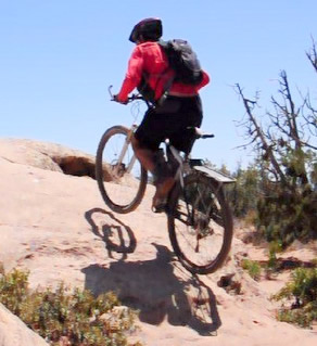
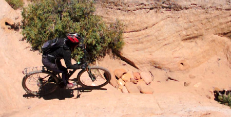
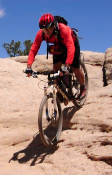
The Gooseberry Mesa loop is a classic ride in SW Utah. It’s a lot of fun if you like slickrock but it has a good mix of that and single tracks going through juniper forest. The entire ride is at the top of a mesa just across from Zion National Park. From the North leg of the loop you can see the towering colorful peaks in the park. However, the views are also good at the West tip of the mesa and along its South rim. One good thing about this ride is that the sections of the trail on slickrock are marked with white paint. It’s not very ecological but very practical to navigate. Since you can see where the trail goes, you can deviate from it without being afraid of getting lost and choose your line up and down the rocky mounds according to your skills level. If you are not familiar with slickrock, the practice loop is a good place to start and be convinced of how much your tires stick to the rock. The name slick comes from when horses where used to traverse it. Nothing to do with your rubber tires. The South rim is more challenging and therefore a counterclockwise loop is advised if you want to get used to it. Please abuse your bike! It can take so much more than your fear…
 In order to get to the trailhead, coming from Hurricane, take Road 59 towards Colorado City. A few yards before the mile marker 8, turn left (North) at the Gooseberry Mesa sign and follow the well maintained dirt road for about 3 miles. Then turn left crossing a cattle guard and follow this new not that nice dirt road till the trail head for 3.5 more miles. There are restrooms right next to the parking space.
 Gooseberry Mesa has many trails bounded between the North and the South rims. The main road is just in between them. Our version of the ride starts at the first trailhead and we pedal to the White trailhead on the main road. To do this, take the left fork on the road just outside of the parking space and pedal for about a mile. Cross this new parking area and keep on the main road for about 0.3 mi more where the Practice loop starts on your right hand side. Follow the white splotches and start having fun on this easy section of slickrock. After 0.7 mi turn right to get closer to the North rim. Half a mile later, take a left. Half mile more and make a right. Another right after 0.6 miles and you’ll be on the North rim. Enjoy the views of Zion and the multicolor strata below you.
The next 1.2 miles will take you along the rim and back to the main road where you should take a right. After 0.7 miles of road and single track you get to the out-and-back trail to the West tip of the mesa. This is where the real fun starts. The slickrock sections become more difficult: short but steep climbs and downclimbs, sharp turns and even cracks to go over scarily close to the cliffs. The scenery from the viewpoint is worth the 0.45 miles to it. Once you come back to the out-and-back point, take a right and start your ride on the South rim. The next 1.8 miles are probably the most challenging ones but not that extreme as the sign say. At this point keep straight and ride some more 0.9 mi, then make a left to start getting close to the main road. After 1.1 mi, turn right before hitting the road to enjoy more single tracks and slickrock. 1.5 miles later you reach the White trailhead. Turn right and head back to your car on the main road about a mile away.
Don’t underestimate the time it takes to ride on this terrain. You’ll be stopping at junctions to choose your way and maybe trying several times the obstacles you couldn’t pass in your first attempt. This is not a ride for fast riders but to test your balance and stamina on short impossible climbs and short frightening drops.
Gooseberry Mesa Profile.


