Download GPS files for Guacamole Loop: (Right-click and Save as)
• GPS track & waypointsLodging and eating:
• Benja Thai & Sushi (Saint George)
 Guacamole Loop
Facts:
Distance: 12.9 miles
Elevation gain: 500 ft.
Total descent: 500 ft.
Duration: 4:40 h.
Date: 5/28/2012
Description of the route:
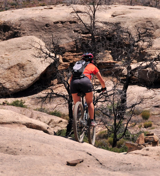
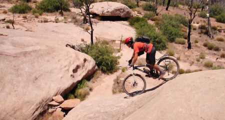
The Guacamole loop is a superfun ride right next to Zion National Park, similar to Gooseberry mesa in style and difficulty but shorter. It’s very enjoyable if you like slickrock but it has a good section of single track going through juniper forest (unfortunately partially burnt). The entire trail is at the top of a mesa and therefore there is very little elevation gain. The route is a lasso shaped figure. The loop at the end is the slickrock section while the out-and-back section to get to the loop is mainly a fast single track with some easy stretches of rock. This route is not marked with paint (like the Gooseberry Mesa) but with cairns. This makes navigation more challenging but it’s marked often enough to find the next pile of rocks before you doubt which way to go. The only inconvenience we found was some no-see-humm bugs that took good care of our legs when we stopped. So just keep pedaling !!
 To get there, take Road 9 East at La Verkin towards Zion National Park. After 7.5 miles from the gas station, turn left at the Dalton Wash sign. After 1.8 miles on this well maintained dirt road, take the left fork following a precarious sign indicating Hiking and Biking public area. After 1.7 mi, you’ll reach the climb to the mesa. You can park here and ride up or keep driving. This last section is steeper and rougher but any 2WD can make it with care, even with low clearance. It’s 0.7 miles more to the trail head.
Once at the parking area, you’ll see a flat extension of slickrock eroded by the action of the elements. Look for the first piles of rocks to start your ride. Get ready quickly to avoid the bugs. After the slab in front of the parking zone, go through a twisted section of slickrock and then ride on a single track. Watch out for the short cacti on the edges of the trail.
About 1.6 miles on the single track, you’ll get to a fork not that visible. The right leg takes you to a viewpoint at the edge of the mesa cliff. We kept straight and visit the viewpoint on our way back. At mile 2.1 from the beginning, you will arrive at the loop. The mounds at the beginning of the loop offer some stunt options to start testing your ability. We did the loop counterclockwise but found other riders doing it on the opposite direction. Either way is equally fun.
At mile 3.2 you will get to a crack on the rock. You can ride across or follow it for an easier path. At mile 4.7 you’ll find the fork for the viewpoint (left). After enjoying the scenery from atop, go back to the main trail, take a left and head back to the car.
Don’t underestimate the time it takes to ride on this terrain. You’ll be stopping at junctions to choose your way and maybe trying several times the obstacles you couldn’t pass in your first attempt. This is not a ride for fast riders but to test your balance and stamina on short impossible climbs and short frightening drops.
Guacamole Profile.


