• Logbook
• Road Stars
Photo album:
• El Leoncito N. P.
Lodging:
• San Juan Hostel
Download GPS files for El Leoncito NP:
• GPS track & waypoints
In this stage we go through the western arid valleys of the San Juan province to visit the Leoncito National Park and its astronomical observatories. Then we continue towards the town of San Juan, the capital of the province.
Stage index:
May 26, 2011: From Uspallata to San Juan province´s border (Profile)
May 27, 2011: From San Juan province´s border to El Leoncito NP (Profile)
May 28, 2011: From El Leoncito NP to Calingasta (Profile)
May 29, 2011: From Calingasta to RN149 (Profile)
May 30, 2011: From RN149 to San Juan (Profile)
From 26 to May 30, 2011

It takes us a couple of days from Uspallata to the Leoncito National Park. In the outskirts of Uspallata there is a native site where you can visit the ovens the Indians used to melt metals from the nearby mines, but it is closed for no apparent reason and we cannot visit them. A few kilometers from the village there is an indigenous community, but the site is totally run down and we don´t even stop.
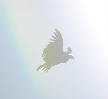
The park's fauna and flora are nothing spectacular either. It's supposed to be inhabited by guanacos and pumas, but it's so big that it´s almost impossible to spot them. The real reason for the existence of the park is that this is a fabulous area for astronomical exploration due to the clear sky and lack of clouds.
At the park campground we meet Jan, a German guy who writes for astronomy magazines. Tonight we will go with him to visit the Felix Aguilar Observatory, the closer of the two to the campground. The telescope used for the night visit magnifies up to 70 times, a little bit too short to see comfortably some of the celestial objects but still worth it. The tour begins with open and closed star clusters followed by one of the most famous stars of the southern hemisphere: Antares, in the Scorpius constellation. One of the common Argentinian beers in the South is named after it. Then the guide with his laser pointer indicates some of the constellations only visible from the southern hemisphere like the Southern Cross, Centaurus and Scorpius. We can also clearly see the two Magellanic Clouds, two irregular dwarf galaxies and, of course, the Milky Way, our galaxy. Finally, we observe Saturn with its spectacular rings.
Next morning we visit the same observatory. The day tour shows the main telescope and some rooms with photographs taken with it. One of the main tasks of this center is the detection of objects that come too close to Earth. Any object that gets closer than 5 million miles is considered hazardous. Some data for hypochondriacs: on April 13, 2029, the Apophis asteroid will pass just 22,000 mi away from us. And on March 16, 2880, the 1950 DA asteroid could collide with Earth. At that time, the asteroid will be traveling at about 39,000 mph. For curious on these subjects, here you can read about The Strange Case of Asteroid 2002 AA29 (only in Spanish).
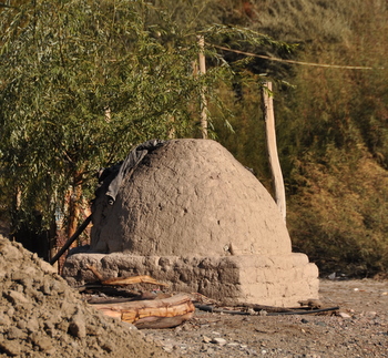
On the fourth day of this stage we leave the Andes range following the San Juan river. This valley has a little more greenery on the riverbanks and pedaling becomes more entertaining. Along the way we find a series of constructions that look like remnants of a mineral extraction or processing plant, but we can not tell for sure. The plant is abandoned, but there are sulfur deposits in the empty pools.
At the pass there is a shrine to Our Lady of Lo-Vasquez, protector of travelers. To obtain her protection, we follow the instructions posted and water the trees planted around the shrine. Everything is ready to fulfill the ritual. Devotees have left a tank filled with water that they refill from time to time. The trees have buried newspaper around the base of the trunk to conserve moisture better... As we carry out the task, the driver of a passing truck, in addition to wave us, crosses himself. We have noted this habit on several occasions when drivers pass in front of a shrine or church. The funniest ones are the motorbike riders, who must release the accelerator to cross themselves.
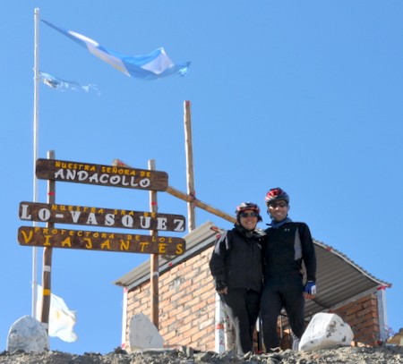
Down at the valley, a layer of low clouds still covers the view. It will take us a long day to get to San Juan, to find another big city and its traffic. We finally arrive at the hostel where we are staying and can relax.
We will spend a couple of days in San Juan due to technical problems, but that´s part of the next story.


