• Logbook
• Road Stars
Photo album:
• Incallajta Ruins
Download GPS files for Quebrada de Humahuaca:
• GPS track & waypoints
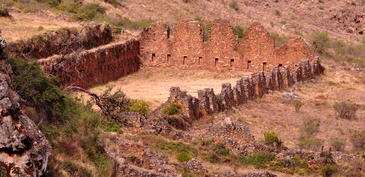
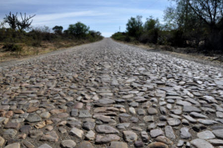
On this stage we ride from Sucre to the Incallajta archaeological site, located near the old road linking Cochabamba with Santa Cruz. Incallajta is the second largest archeological site in Bolivia, after Tiwanaku. Along the way we see the beginning of the transition from the Andean highlands, arid and scarce in natural resources to a new region, still rugged but with several rivers that make vegetation more abundant and crops more varied. The altitude is lower and the temperature considerably higher. People keep talking mostly Quechua, but it sounds different and in fact, they mix some Aymara. The road has a major drawback for cyclists: there are about 60 mi of road paved with cobblestones. Even if you have the best saddle and the best shorts, so many miles of stones will get your butt wrecked.
Stage index:
August 2, 2011: From Sucre to Puente Arce (Profile)
August 3, 2011: From Puente Arce to Aiquile (Profile)
August 4, 2011: From Aiquile to nowhere (Profile)
August 5, 2011: From nowhere to Totora (Profile)
August 6, 2011: From Totora to Epizana (visit to Incallajta) (Profile)
Profile for the entire stage:
August 2, 2011: From Sucre to Puente Arce
The bus terminal is on our way to the national road 5, that goes from Sucre to Cochabamba and then to Santa Cruz. From the terminal we ship the box to Santa Cruz, where we will pick it up in a few days. The exit of the city goes through an avenue with lots of car repair shops. As it should be, each one has the typical calendar with good-looking girls in bikini (or without). In Bolivia, in any kind of advertisement there is always a girl with good body and very little clothing. We're not just talking about beer ads, but ads of car wheels, motors, generators, concrete... Probably any tool or material that is traditionally purchased by men.
Once outside the city, the road continues to climb gently until it almost reaches 10000 feet. From there, we descent more than 2600 feet down to the valley of the river we will follow the whole day. Today we will stop at Puente Arce, at 4900 feet of altitude, 4300 lower than Sucre. However, accounting with the climb out of the city and the frequent ups and downs of the road that runs parallel to the river, the total accumulated downhill is approximately 6900 feet (that means, oddly enough, 2600 feet of accumulated climb). Once in the valley, the landscape is not spectacular but at least greener than at higher altitudes. Cacti, shrubs and sparse trees are mixed. At noon, the heat is very strong and the dry air forces us to drink continuously. We didn’t expect this change in temperature and, clearly, we're not properly dressed. The thick tights and black sweaters are too warm. It continues to surprise us (pleasantly) the little traffic, even this being a major road. Most vehicles are trucks, but very spaced. The buses connecting Sucre with Santa Cruz and Cochabamba depart in the afternoon and travel overnight, so they don’t bother us while pedaling.
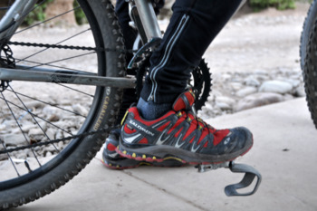
At the end of the downhill we reach the Arce bridge, where the asphalt ends and just a few feet away is the population of the same name. It’s a tiny village with some stores selling the basics and, yes, a football court. We ask for permission to camp there to the store owner where we get water from. While we set up the tent, we receive all types of visitors, dogs, pigs, chickens, goats... More than a sports court, it looks like a corral. We just have enough time to "improve" the orientation of the toe clip before it gets dark and the mosquitoes appear.
August 3, 2011: From Puente Arce to Aiquile
Well, today it starts worse than yesterday. Not because the roosters wake us up before 6:30, not because the piglets grunt walking around the tent, not even due to the noise the passing herd of goats produces on the concrete on the football court, but because a damn dog pees on the tent. Since yesterday was hot when we got in the tent, we put the door flier above the tent and just closed the screen door. This morning I was awakened by Judit shouting to scare the dog away, but it was too late. The repulsive dog had already marked territory where I had my head. Well, probably not too late, at least the yell served to avoid a golden shower on my head. Anyway, now that corner stinks of dog pee. To try to remedy it, we buy alcohol in one of the little stores and scour the affected area. I believe that dogs have cursed me. Since I grab a rock and threaten them when they approach barking, they take revenge and pee on my saddlebags (like when we were going to El Chaltén) or now on the tent. Anyway, with that look of repugnance that stays in your face in cases like this, we pick up everything and set off.
August 4, 2011: From Aiquile to nowhere
Today is not going to be our lucky day either. We ask the motel owner how is the road to Totora and his response is: "Cobblestones". No way. It is impossible that the 44 mi to Totora are like the 500 yards entering Aiquile. But the owner is positive. 44 mi of cobblestones is going to be hell. Who had the idea of paving 44 miles of road with cobblestones?
August 5, 2011: From nowhere to Totora
Today we find less sandy shoulders, less accumulation of dirt and therefore, our already sore butts, suffer more. At the end of the 14 mi that separates us from Totora our butts are like a “ducks trough”. This is an expression used by a colleague at the Barcelona office. Josemi sure remembers. The author used it in a context like: "If you do not finish this work on time, I’m going to make your butt look like a ducks trough". I never understood its meaning until today. Somebody guaranteed us that from Totora and on, the road is paved, but we still don’t believe it.
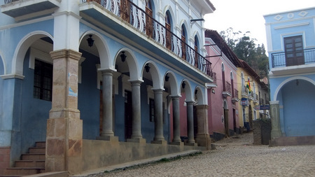
August 6, 2011: From Totora to Epizana (visit to Incallajta)
It exists! The asphalt exists! There, at the end of the main street, where the road to Epizana begins, cobblestones are replaced by smooth asphalt. The route to Epizana, located on the old road that goes from Cochabamba to Santa Cruz is mostly downhill. This, along with the evenness of the pavement is a pleasure for our sore butts. Arriving at Epizana we look for accommodation for the night and leave the saddlebags there. The plan is to continue with the bikes to the ruins of Incallajta, a few miles towards Cochabamba. Before leaving Epizana we ask about the way and they give us great news: from the turn off of the road to the ruins, the road is paved... with cobblestones!
Once the bags are unloaded, we take Highway 7 to Cocha. This is usually a windy area. In fact, there is a wind farm in Kollpana. In our map, the junction to Incallajta is at the village of Monte Punktu, but when we get there they tell us that we've passed it. As usual, in Bolivia, the signs are inexistent. We turn around and ride now downwind, 2 miles from Monte Punktu, now we see a small sign indicating Pocona (non-existent in the other direction), where we are headed. And finally we ride on cobblestones again. We were missing them… At least the 8 mi from the road to the fork that leads to Incallajta are downhill. The road to the ruins (also paved with cobblestones) is uphill though and the return back to the road also. This pavement has almost no dirt areas on the sides to reduce the shaking. After a few miles down, Judit feels her kidneys trembling. And again we get a flat due to the thorny vegetation close to the shoulders. Once we have the new tube installed and inflated, when removing the pump, the valve comes out with it! The pffffffff sound is accompanied by a face of skepticism for what happened. Fortunately we carry a second spare tube and do not need to repair the flat right there. Finally we reach the junction up to Incallajta. At the first curve we already see the steep slope traffic signal. We recalculate the time it will take us and seeing that it is more than 1 PM, we realize we do not have time to do it by bike. At that time, a couple of cars approach. The first passes by, but the second one takes the sharp turn and faces the uphill to the ruins. It is a small car and the bikes will not fit, but we do. We stop them and ask them if they can give us a ride. The answer is yes so now we have to find a place to leave the bikes. Half mile back we just passed a house, so we go back to ask if they can keep the bikes until we return from the ruins. On top of this, a pick-up truck is parked at the door and we ask if we they can take us back to Epizana. All the answers are positive, so we have solved the logistics and we avoid the ride back. We have been fortunate to meet with Elmer, the driver, as in the 5.6 miles up to the ruins we climb 300 yards. He lives in the village of Incallajta, about 2.5 mi before the archaeological site. Passing through the village he drops off her wife and we continue to the visitor center. We convince him to do the tour with us instead of waiting for us in the car. We hire a guide and start the tour of the archaeological site.
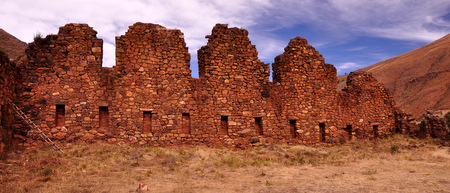
After the visit, Elmer takes us back to the house where we have the bikes. The surprise that awaits us is that the owner of the pick-up tells us that it has no gasoline. There's also a normal car parked that does have gas, but the bikes don’t fit. It's 4:30 and we begin to fear the worst: having to pedal back up the cobblestones and with head wind. But in Bolivia, there is always a solution. Not understanding very well why, he goes looking for his son somewhere. 20 minutes later the son repeats the same story about the fuel. We do a futile attempt to put the bikes in the car. Also the car runs on gas and the tank is inside the trunk, further reducing the available space. Suddenly he says that he will move the car battery to the pick-up and we are ready, sure we get to Epizana with the little gasoline it has. Without trying to understand anything, we load the bikes on the truck, push it to start the engine, we get in front and pray for not running out of gasoline. In one hour we are back in Epizana. In short, a full day, with asphalt, cobblestone pavement, cultural tour, suspense and a practical test of improvisation to work out unexpected situations with the resources we have at hand. Of course, the good will of the people here, and it must be said, an economic incentive, helps.

